Follow this guide to draw paddock boundaries (against a Satellite image) and assign these to the Paddock Names within your Adviser program. It is also possible to create new Paddocks this way, rather than typing names into the Farm section.
Open Background Image for Drawing
Terminology buster
These settings can help make your boundary mapping much more user-friendly!
Snapping: Allows boundary fences to automatically be shared when creating adjacent paddocks
Snap nodes: Allows nodes or corners to be shared
Node numbers: Allows visual representation of ‘node’ order
Auto Area: Allows program to calculate paddock area based on your image – accuracy depends on your accuracy with image and dropping paddock nodes. Click on or off as required. Ensure two decimal points are being used to increase accuracy by selecting 0.00 in the drop down box below. If this is selected, it will override the area data already existing in your client file
Create Paddock Polygon
 or
or  - personal preference)
 from top toolbar when ready to draw boundaries
A polygon will be created. Press Edit  or Delete
  if not correct, or continue if satisfactory. Please note: to make small changes to a polygon it is often much easier if “Snapping” and “Snap Nodes” are turned off.
Assign Paddock Names to Polygons
If this has been labelled correctly, you will now see a boundary and a Paddock Name in the centre of your new paddock. Continue to Create New Polygons for your remaining paddocks.
Note: If paddocks are adjacent and share boundary fencing, this is a good time to turn “Snap Nodes” and “Snapping” on by ticking in their box.
Tip: If creating a very complex polygon it may end up crossing over itself. If this occurs Clear the created polygon and try creating the shape in the opposite direction.
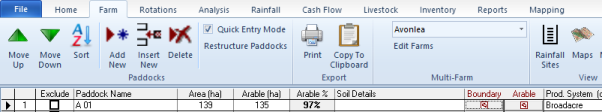
Your paddocks have now been successfully imported, and your Paddock Boundaries created. To view these or print image, follow instructions below:
View and Customise
Now that your boundaries have been created successfully, they can be viewed within the program or even printed.
View boundaries

You should now be able to see your background image, with a Paddock Boundary layer. To adjust the appearance of this including fonts, follow instructions below.
Customise your Map Layer
The default map settings are nice, but we like to give you a few more options at Back Paddock. Follow instructions below to make your boundaries look the way you want:
